Aerial Maps and Diagrams of RCAF Station Marville


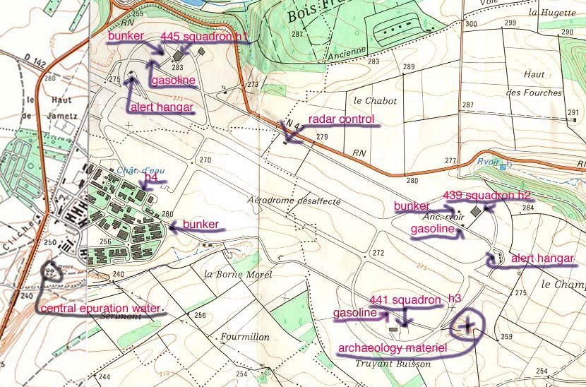
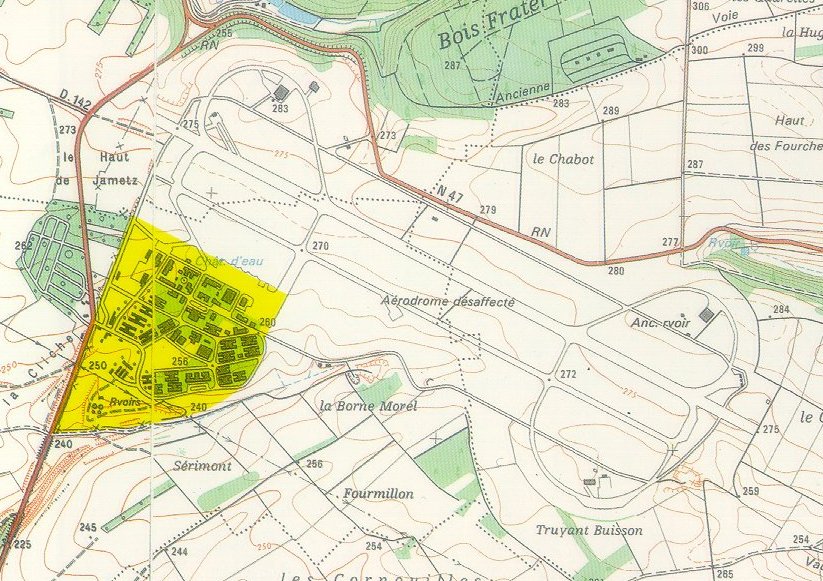
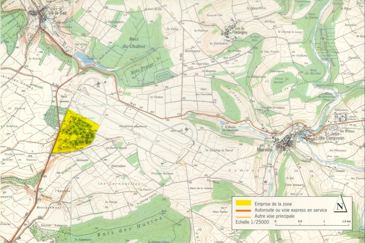
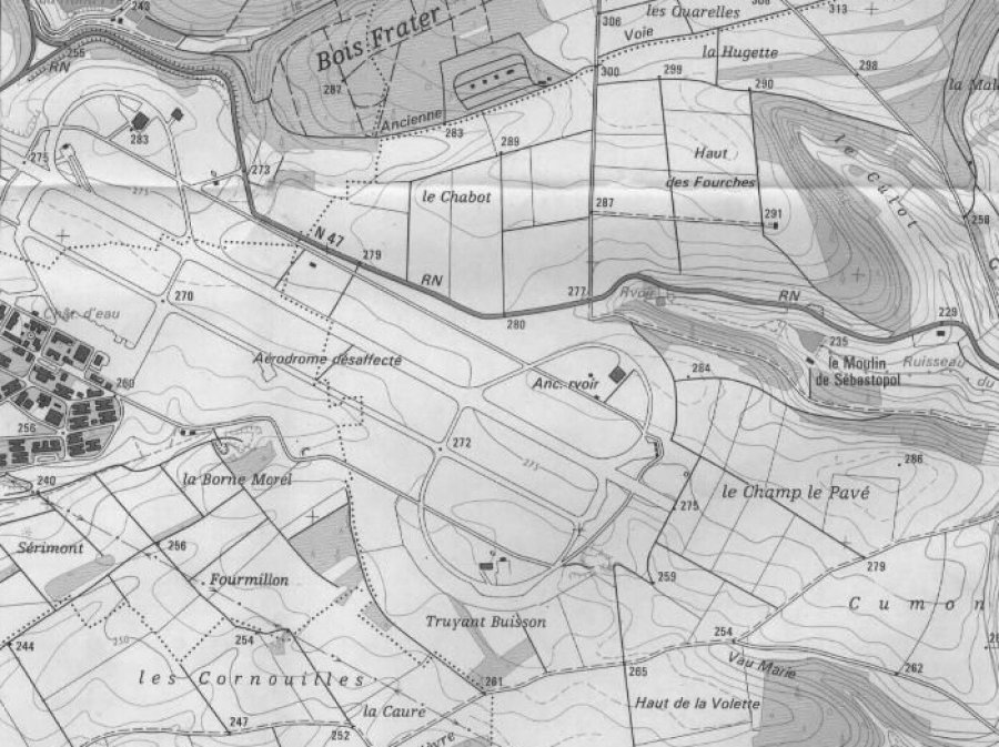
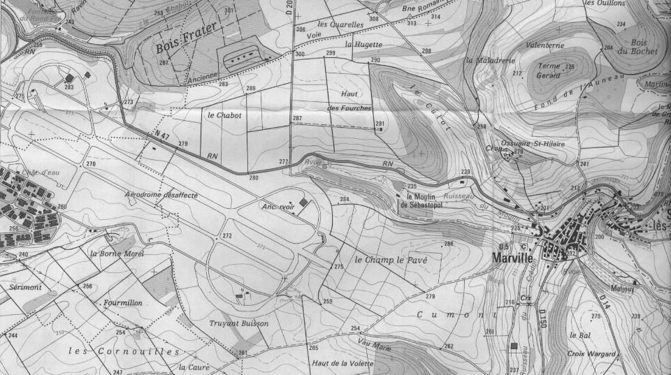
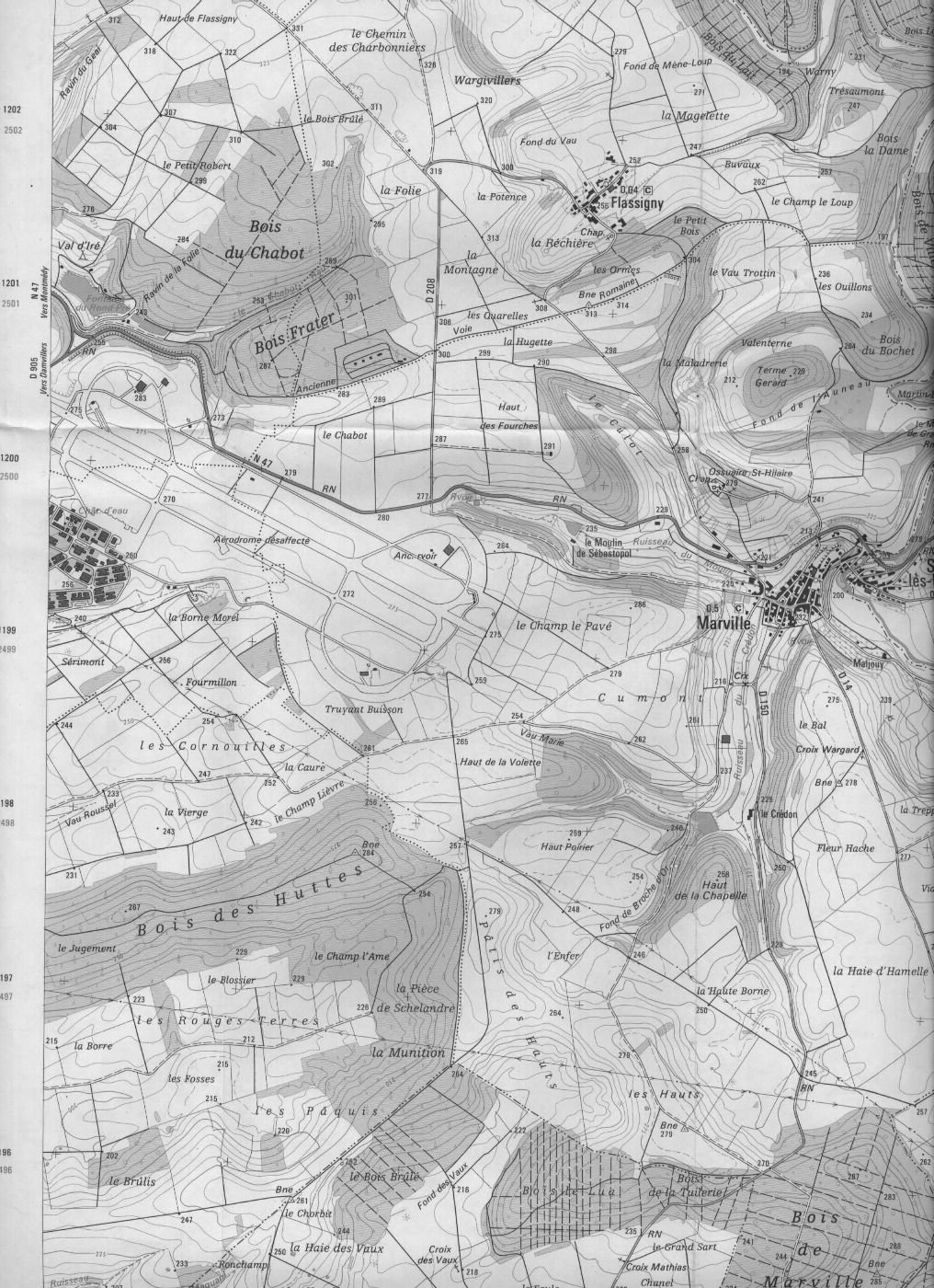
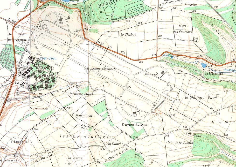
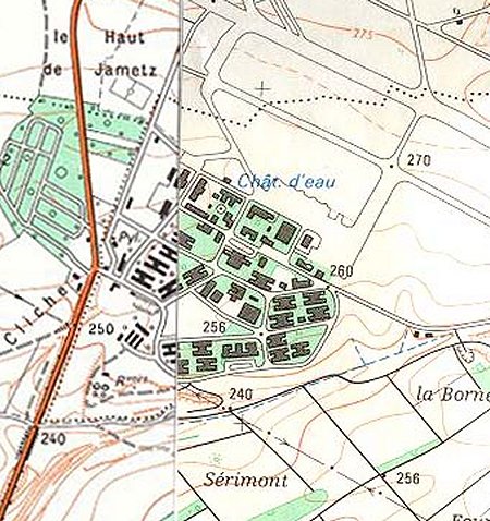
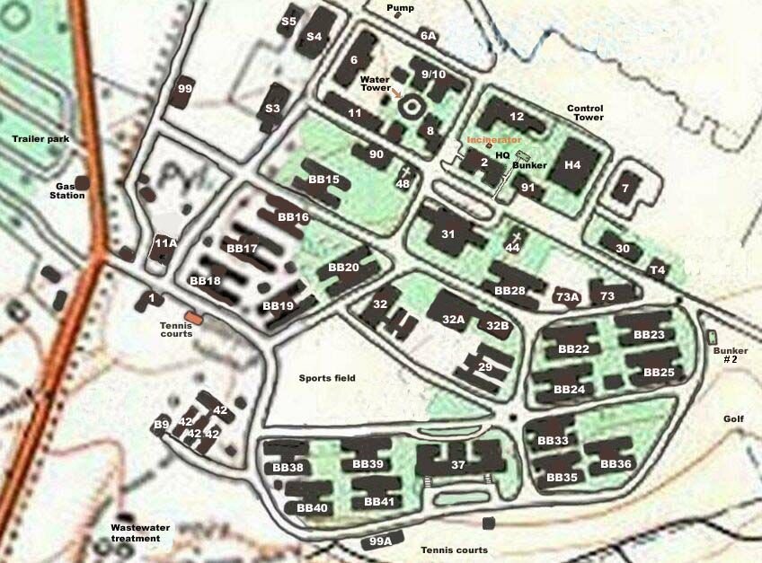
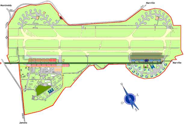
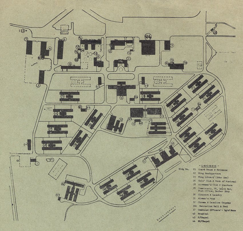
Everyone who ever served at RCAF Station Marville has, at one time or another, wondered "what still exists at 1 Wing"?

This question can be answered somewhat - if one carefully looks at the aerial maps and diagrams that are presented below.


Click on the description text to view the photograph.
  1. Aerial map of the airfield (830 pixles - 161K) - 2003
    Courtesy of Remy Labriet

  2. Aerial map of the airfield (750 pixles - 127K) - 1999
    Courtesy of Pierre Baar

  3. Aerial map of the airfield (823 pixles - 166K) - 1999
    Courtesy of Pierre Baar

  4. Aerial map of the airfield and local area (1200 pixles - 313K) - 1999
    Courtesy of Pierre Baar

  5. Aerial map of the airfield (900 pixles - 158K) - 1998
    Courtesy of Ren L'Ecuyer

  6. Aerial map of the airfield (960 pixles - 175K) - 1998
    Courtesy of Ren L'Ecuyer

  7. Aerial map of the airfield (1016 pixles - 421K) - 1998
    Courtesy of Ren L'Ecuyer

  8. Aerial map of the airfield and the domestic site (978 pixles - 223K) - 1998
    Courtesy of Ren L'Ecuyer

  9. Slightly larger image of the domestic site - 1998
    Courtesy of Ren L'Ecuyer

  10. Aerial diagram of RCAF Station Marville - 1998
    Courtesy of Andy Little

  11. Aerial diagram of RCAF Station Marville - 1964
    Courtesy of Bob Jackson

  12. Aerial diagram of RCAF Station Marville - 1957
    Courtesy of Robert Hutcheon


Return to Top of Page

About This Page

Updated: November 4, 2003