|
Grostenquin Home Page |
Locations |
Grostenquin Resources |
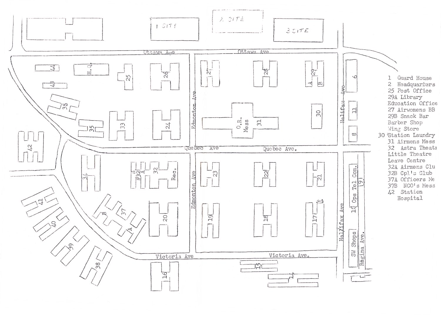
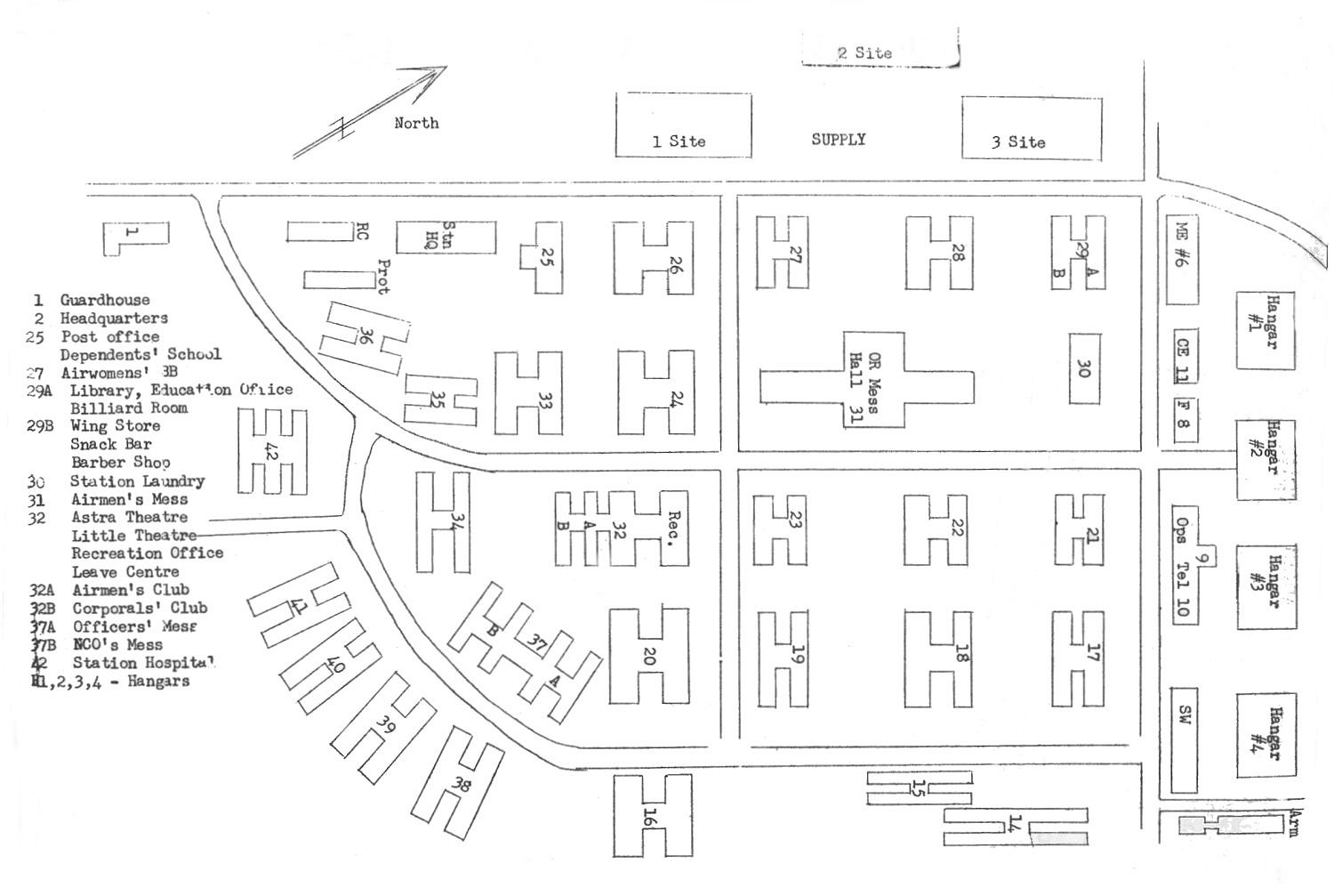
In an attempt to bring back some memories, we offer two views of RCAF Station Grostenquin, and a "Legend" which identifies the use of the major buildings on the station. There are, however, some very important things to remember when looking at this material. Some of these points are as follows:
We have not been able to pin-point the exact time that the aerial photo was taken, although we suspect that this was in the 1958-1959 time period. This means that if you served at 2 Wing in the early to mid 1950s, there is a good chance that you are not aware of buildings which were constructed after your departure. Equally important, if you happened to serve at 2 Wing between 1960 and 1964, then there is a chance that some of the buildings which were constructed during the 1960-1964 time period will not be depicted on these diagrams. We should also bear in mind that a building can be identified (in the Legend) as being used for a specific purpose - based on input from someone who recalls it as such. We should remember that building use may have changed a number of times over the years. And yes - one other thing to take into consideration is the fact that we are all that much older - and perhaps, just perhaps, our memories are not as sharp as we think they could or should be.
Having said all of this, we offer these diagrams and building identification based on recall from the 1958-1959 time period. It is hoped to expand this section with the passing of time with additional station diagrams - made available from other sources, and other years.
|
| Return to Top of Page |
Updated: April 10, 2005