Click on the description text to view the map.
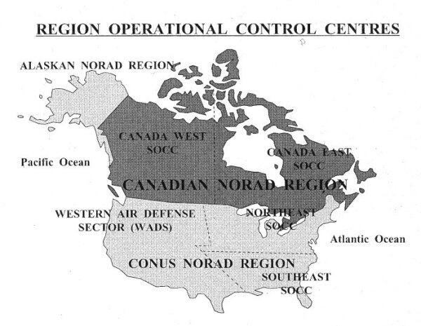
- Region Operational Control Centres.
Courtesy NBC Group.
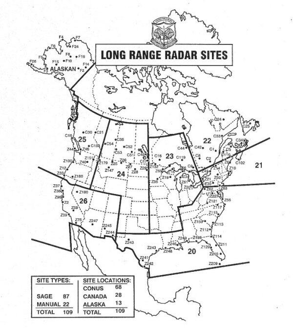
- Long Range Radar Sites - Circa 1975.
Courtesy NBC Group.
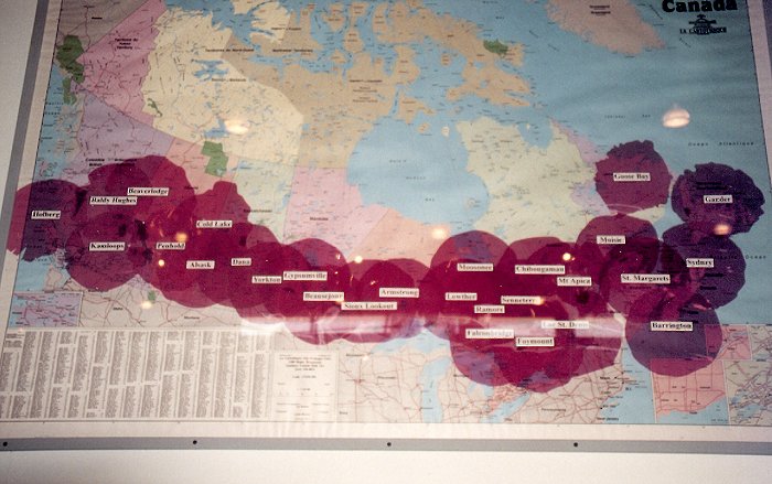
- Pinetree Line long range radar coverage for 28 active sites - Circa 1970.
Note the marked absense (due to closures) of 16 other sites - as follows: Tofino, Comox, Puntzi Mountain, Pagwa, Edgar, Parent, St. Sylvestre, Beaverbank, Stephenville, St. Anthony, St. John's (Red Cliff), Cartwright, Hopedale, Saglek, Resolution Island and Frobisher Bay - all of which were closed between 1957 and 1970.
Courtesy Bob Agar.
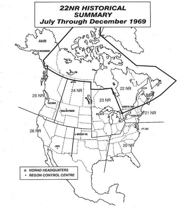
- 22NR Historical Summary - July through December 1969.
Courtesy NBC Group.
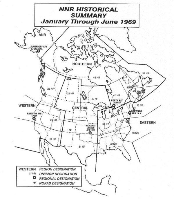
- NNR Historical Summary - January through June 1969.
Courtesy NBC Group.
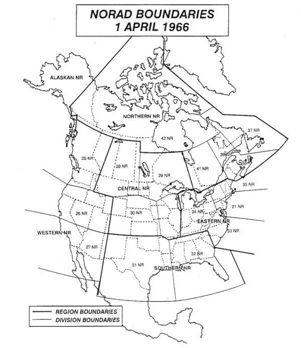
- NORAD Boundaries - 1 April 1966.
Courtesy NBC Group.
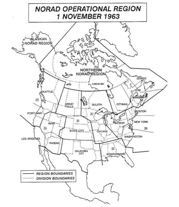
- NORAD Operational Regions - 1 November 1963.
Courtesy NBC Group.
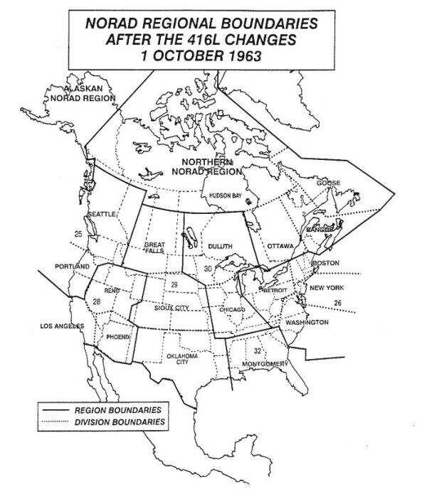
- NORAD Regional Boundaries - 1 October 1963.
Courtesy NBC Group.
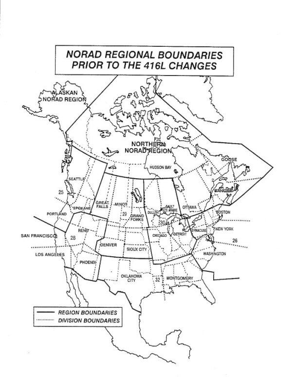
- NORAD Regional Boundaries - Pre 1 October 1963.
Courtesy NBC Group.
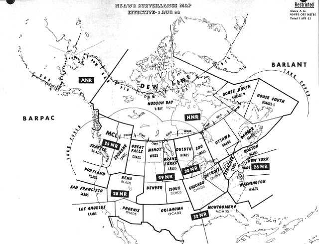
- NSAWS Surveillance Map - 1 August 1962.
Courtesy National Archives of Canada.
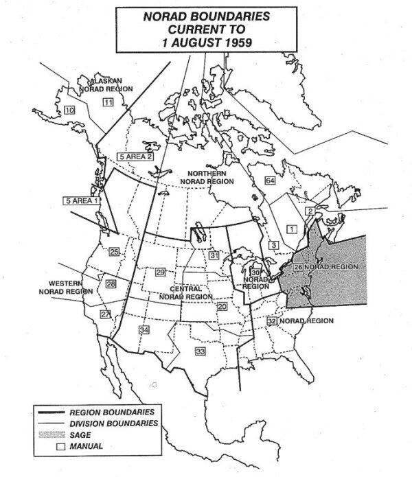
- NORAD Boundaries - 1 August 1959.
Courtesy NBC Group.
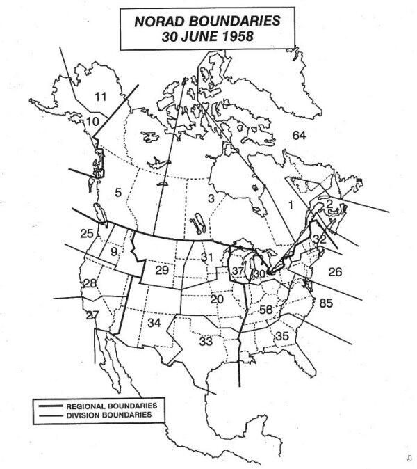
- NORAD Boundaries - 30 June 1958.
Courtesy NBC Group.
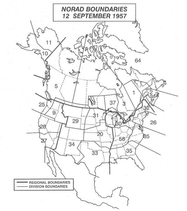
- NORAD Boundaries - 12 September 1957.
Courtesy NBC Group.
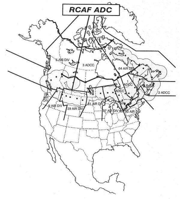
- RCAF ADC Boundaries - Pre 12 September 1957.
Courtesy NBC Group.
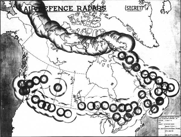
- Radar coverage by the Pinetree Line along the border and by the then proposed DEW Line in the north are shown on this map prepared by Air Defence Headquarters - 30 November 1955.
Courtesy National Archives of Canada.
|